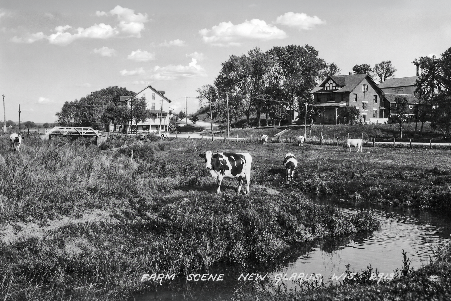
An undated historic photograph of New Glarus offers a rare look at the Little Sugar River valley before Highway 69 was built through the area and before land now associated with Roy’s Market, Valle Tell Park, Grossenbacher Lane and Elmer Road took on its modern form.
The image shows a quiet farm scene, with cattle grazing near the river, a bridge in the distance, a farmhouse on the right and another large building on the left. The date of the photograph is uncertain, but the scene almost certainly predates the modern Highway 69 alignment through the valley.
The farmhouse on the right has been identified as 602 Elmer Road. The building on the left, no longer standing, is believed to have been located near today’s 517 Elmer Road and may have served as a hotel at the time. The barn visible behind and to the right of the farmhouse is believed to have stood on what is now the lot at 100 Grossenbacher Lane.
Remaining content is for paid members only.
Please subscribe to any paid plan to unlock this article and more content.
Subscribe Now