Severe Thunderstorm Strikes Green County
Damaging winds up to 70 mph, hail and the possibility of tornadoes have prompted a severe thunderstorm warning for southwestern Green County as a fast-moving line of storms pushes northeast across southern Wisconsin this afternoon.


UPDATE: Democratic State Senate candidate District 17 forum is still on.
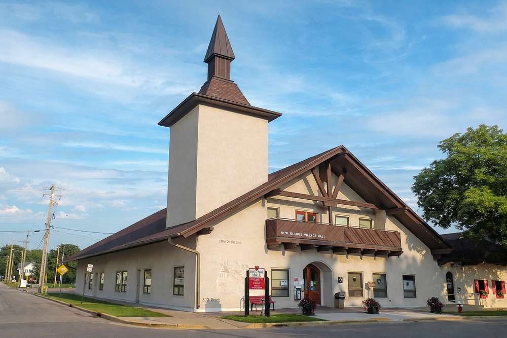
UPDATE: New Glarus Home car show has been cancelled due to weather, but the crowning will now be in the New Glarus Home Chapel at 6pm.
UPDATE: Updated severe storm warning expired at 3:00 p.m.
UPDATE: Power was restored a second time in downtown New Glarus at 2:56 p.m.
UPDATE: New Glarus Cares has postponed Wednesday evening's pickleball fundraiser bingo event at Bailey's Run Vineyard due to storm-related concerns.
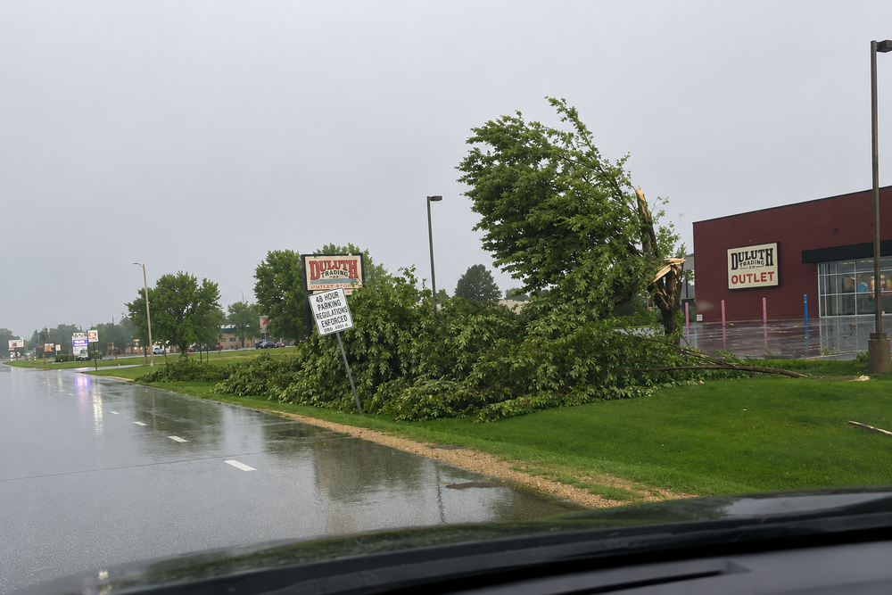
UPDATE: Trees have fallen onto at least two homes in New Glarus, including residences in the 200 block of Pierce Street and the 200 block of Garfield Street (possibly in Monticello). Dispatchers also received reports of a tree blocking the 900 block of Second Street and additional downed trees across the area.
UPDATE: Argue Road is reportedly closed on the southern end. Two trees completely blocking road south of cardinal crest.
UPDATE: Large tree down at 1219 4th Street
UPDATE: Another band of storms will be moving through shortly, but not as strong as the previous storm. Rain is expected to end around 4 p.m.
UPDATE: Severe thunderstorm warning extended until 3:00 p.m.
UPDATE: Power went out again in downtown New Glarus at 2:33 p.m.
UPDATE: Severe thunderstorm warning expired 2:30 p.m.
UPDATE: Township west of the village never lost power.
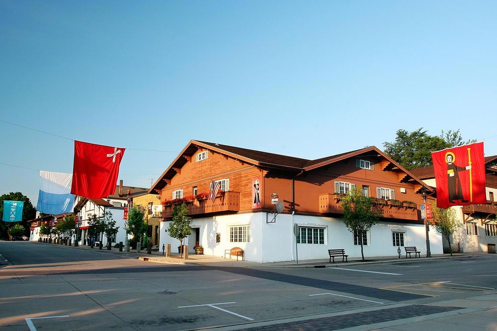
UPDATE: Power restored to downtown New Glarus at 2:26 p.m. Church bells played at 2:30 p.m.
UPDATE: Transformer at 114 6th Avenue transformer on fire.
UPDATE: Power out in downtown New Glarus, Wisconsin. An arcing or overloaded transformer could be heard before power went out.
UPDATE: New Glarus Fire Department crew dispatched. More details soon.
UPDATE: 85 MPH winds measured near Monroe (1:35 p.m.)
UPDATE: Power flickers twice in New Glarus but remains up.
UPDATE: 85 MPH gust reported in Monroe.
UPDATE: 88 MPH wind gust reported in Darlington, Wisconsin.
STORM CHASER #1 LIVE: https://www.youtube.com/watch?v=Dv1mBJLpOkk
STORM CHASER #2 LIVE: https://www.youtube.com/watch?v=YTv3U37ypos
A severe thunderstorm warning is in effect for southwestern Green County and Lafayette County until 2:30 p.m., with 70 mph wind gusts, hail and possible tornadoes.
The National Weather Service in Milwaukee/Sullivan has issued a severe thunderstorm warning for southwestern Green County and Lafayette County until 2 p.m. Wednesday.
At 12:38 p.m., severe storms were located along a line extending from near Earlville to near La Motte to Albany and were moving northeast at 45 mph, according to the National Weather Service.
The warning includes the threat of 70 mph wind gusts and penny-size hail. The National Weather Service said considerable tree damage is expected, with damage likely to mobile homes, roofs and outbuildings.
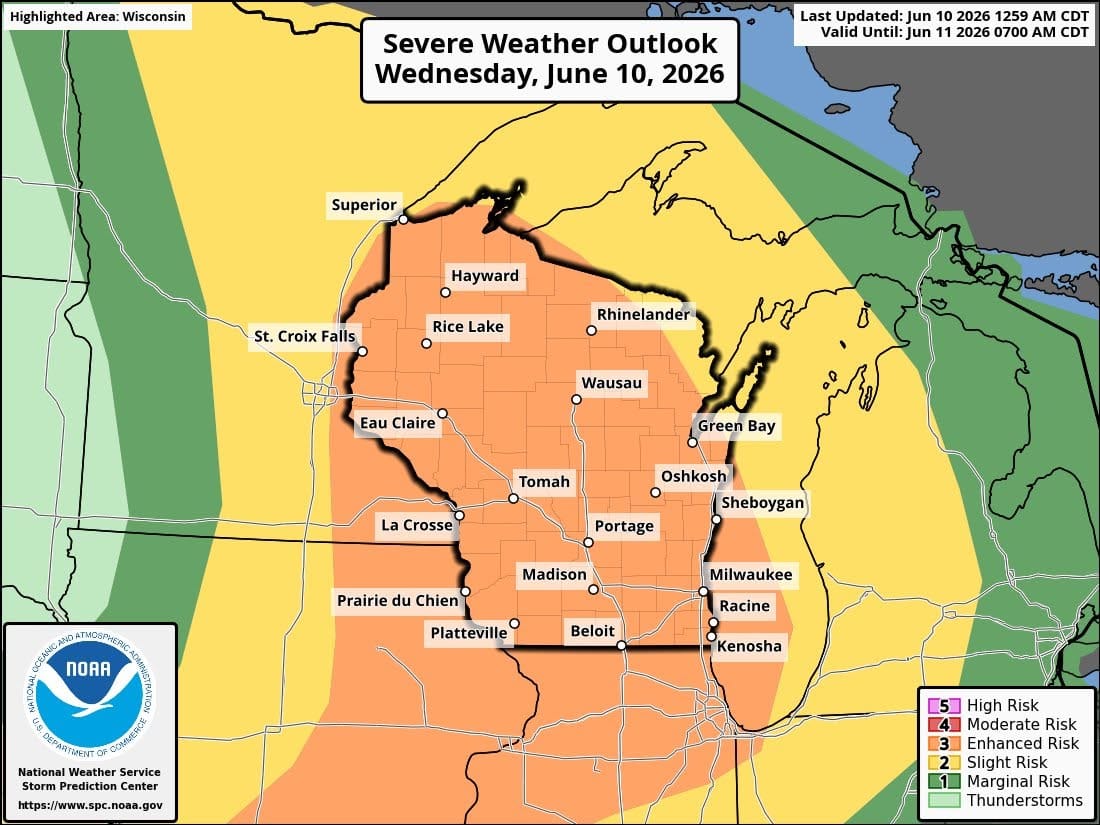
Residents are urged to remain alert for a possible tornado. Tornadoes can develop quickly from severe thunderstorms, and anyone who sees a tornado should go immediately to a basement or small central room in a sturdy structure.
The warning area includes Monroe, Darlington, Shullsburg, Belmont, Benton, Argyle, Blanchardville, South Wayne, Browntown, Gratiot and other nearby communities.
A severe thunderstorm watch remains in effect for the broader area until 7 p.m. The forecast calls for additional showers and thunderstorms this afternoon and tonight, with some storms possibly severe and capable of producing heavy rainfall.
Thursday also carries another storm risk, with showers and thunderstorms likely and some storms capable of producing heavy rainfall.
– Follow New Glarus 360 for more New Glarus breaking news, weather alerts and Green County updates.
– Sources: Green County Sheriff’s Department, National Weather Service Milwaukee/Sullivan, NOAA Storm Prediction Center
– Licensed stock photo
Sign up for our New Glarus 360 newsletters
Breaking news, things to do and alumni updates—delivered.