New Glarus Escapes Worst of Tuesday’s Storms
New Glarus picked up more than an inch of rain Tuesday night, while communities across southern Wisconsin reported large hail, wind damage, flooding, and tornado warnings.


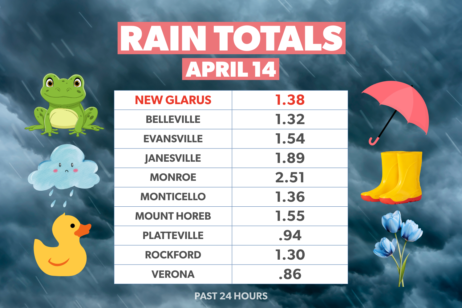
New Glarus came through Tuesday night’s severe weather with heavy rain but little apparent damage, even as other parts of southern Wisconsin were hit by large hail, strong winds, flooding, and tornado warnings. The village recorded about 1.38 inches of rain from the April 14 storm system.
The contrast was sharp across the region. Areas not far from New Glarus saw much more damaging conditions as the strongest parts of the storm line tracked north and south of the village, leaving New Glarus in a relatively favorable position.
Remaining content is for paid members only.
Please subscribe to any paid plan to unlock this article and more content.
Subscribe NowSign up for our New Glarus 360 newsletters
Breaking news, things to do and alumni updates—delivered.