Not long ago, a street corner in the oldest part of New Glarus could carry two identities. The larger sign gave the practical modern address. A smaller sign beneath it recalled the Swiss name the street once carried.
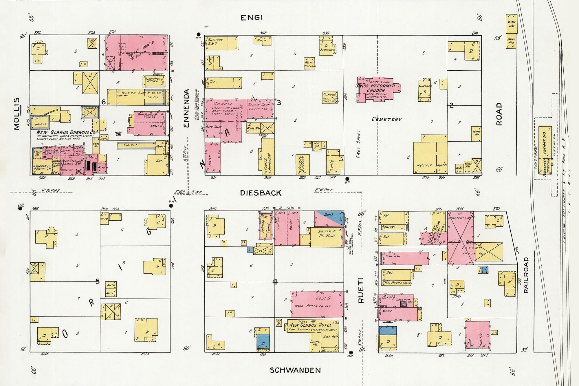
Those historical signs, many of them faded and peeling, have now nearly all disappeared. Their removal erased one of the few public reminders that New Glarus once had streets named Schwanden, Diesbach, Engi, Ennenda, Rüti and Mollis rather than the numbered streets and avenues familiar today.
A July 1919 Sanborn fire insurance map preserves the moment when that older village began giving way to the modern one. The map displays the original names alongside the numbered designations that would replace them.
The older names reached across the Atlantic. When the original 12-block village was platted in 1851, streets were named for communities in Canton Glarus, according to the New Glarus Historical Society. A person walking through New Glarus was also moving symbolically through the geography of the settlers’ homeland.
Remaining content is for paid members only.
Please subscribe to any paid plan to unlock this article and more content.
Subscribe Now